Image from the Shirley Elizabeth Dunn personal collection.
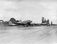
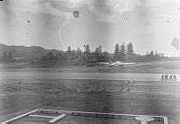
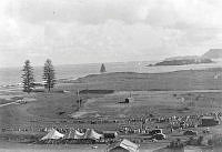
Airfield scene at Norfolk Island. USAAF Dakota 4118578 'Elinor', two No.1 Squadron RNZAF Hudsons, and another USAAF Dakota, with a fire tender in front.
Image from the Gliddon personal collection.
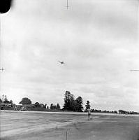
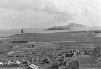
Airfield scene at Norfolk Island, with RNZAF Kittyhawks on the flight line at right, and an ambulance and fire tender at left.
Image from the David Andrew Dunn personal collection.
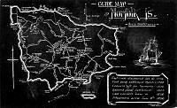
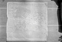
Copy of a tourist guide map of Norfolk Island.
Associated document describes: "guide map of Norfolk Island - pre 1939. The "steel" airstrip was constructed along the pine avenue road. The WNW end of the runway terminated just short of St. Barnabas chapel, the other end terminated not far past Rawson Hall in an ESE direction. The "coral" runway was aligned approximately with New Farm road/Ferry Lane - the intersection of the runways coinciding very near to the Pine Avenue/New Farm Rd - Ferry Lane intersection shown on the map. The RNZAF Radar station was sited on Mt Pitt and personnel of the radar station were almost completely isolated from the rest of the RNZAF establishment on the island. Access to the radar station by "other" personnel was not permitted."
Image from the David Andrew Dunn personal collection.
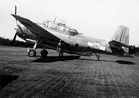
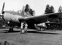
Unknown man standing beside Avenger NZ2510 at Norfolk Island.
Associated document describes: "RNZAF TBFs parked on the edge of the coral strip."
Image from the David Andrew Dunn personal collection.
Unknown man standing beside Avenger NZ2510 at Norfolk Island.
Associated document describes: "RNZAF TBFs parked on the edge of the coral strip."
Image from the David Andrew Dunn personal collection.
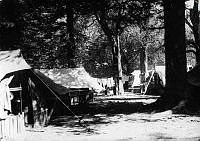
Accommodation tents among trees on Norfolk Island.
Associated document describes: "Part of the original RNZAF camp at Headstone."
Image from the David Andrew Dunn personal collection.
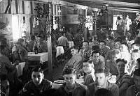
Airmen in the dining room celebrating Christmas. Norfolk Island.
Associated document describes: "Airman's Mess. Xmas Day 1943."
Image from the David Andrew Dunn personal collection.
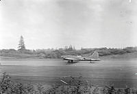
USAAF Flying Fortress landing at Norfolk Island.
Associated document describes: "This Unites States Flying Fortress "lost" an engine in the area somewhere east of Norfolk, became lost, short of fuel, and sent out distress calls which were received by the Norfolk operations room. With the aid of information supplied by the Mt. Pitt radar station and D/F bearings from the control tower, the aircraft was guided to a safe landing at Norfolk. By the time it landed, the aircraft was critically short of fuel and most of the cargo had been dumped overboard through the open hatches on each side of the fuselage. The sight of crew members prostrating themselves on the ground after the aircraft had been parked attested to their joy of again finding mother earth!
Several days later after a Liberator had flown in a replacement engine and it had been fitted, the Fortress departed to the strains of "The William Tell Overture" "sung" by the crew over the command radio as the aircraft gathered speed down the runway and became airborne.
Memories suggest that the name painted on the nose of the aircraft was "The Swoose" taken from the story "The Snow Goose". If this is so, it is probable the aircraft was one of the few survivors, if not the sole survivor of the Flying Fortress squadrons destroyed at Clark Field in the Philippines during the initial Japanese attack. Note that the photograph shows the aircraft is not armed, it having been converted to a transport role."
NB. The above identification may be incorrect.
See also 1986-016.87
Copy negative at MUS980261.
This aircraft is believed to be B17 419211 'Typhoon McGoon'.
Image from the David Andrew Dunn personal collection.
USAAF Flying Fortress taxiing at Norfolk Island.
Associated document describes: "Another photograph of the Flying Fortress pictures in No. 19 [1986-016.3.19]. Note that the starboard outer engine is feathered - probably the motor "lost" in flight. The group of men on the steel runway and another to the left of the aircraft are probably units of the NZ Army garrison stationed on Norfolk at the time."
See also 1986-016.86
This aircraft is believed to be B17 419211 'Typhoon McGoon'.
Image from the David Andrew Dunn personal collection.
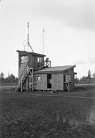
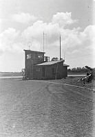
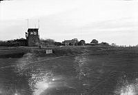
Control Tower at Norfolk Island.
Associated document describes: "Control tower viewed from the same location as photograph No. 6 [1986-016.73], but at a later date, after relocation of the meteorological section and removal of the met. mast. An antenna mast has been added beside the stairs to the control tower to support one end of an antenna for an emergency D/F transmitter located on the ground floor of the building."
Image from the David Andrew Dunn personal collection.
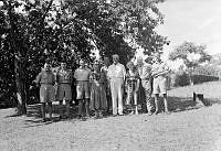
Direction Finding personnel with local people on Christmas Day. Norfolk Island.
Associated document describes: "Captain and Mrs. Quintle [sic, spelled Quintal], an hospitable Norfolk Island couple who resided over the coral strip from the D/F residence invited the D/F operators not on duty for Xmas dinner.
Left to right - Aircraftman GordonFindlay, Jack Litt, Ron Pearce, Mrs. Quintle[sic], Ross Noonam, Captain Quintle[sic], two friends of the Quintles, names not remembered, Corporal Bob Smith."
See also 1986-016.91
Image from the David Andrew Dunn personal collection.
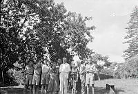
Direction Finding personnel with local people on Christmas Day. Norfolk Island.
Associated document describes: "Xmas day 1943. As for No. 23 [1986-016.90].
Left to right. Aircraftman Jack Litt, Dave Dunn, Ron Pearce, Mrs. Quintle[sic], Ross Noonan, Capt. Quintle[sic], two friends of the Quintles names not remembered, Corporal Bob Smith."
See also 1986-016.90
Image from the David Andrew Dunn personal collection.
High view of the race track for a horse racing event on Norfolk Island.
Associated document describes: "A race meeting was organised by the NZ garrison on Norfolk with either an equilisator in lieu of a tote, or bookmakers. The track was set out around the antenna system for the RNZAF radio navigational beacon (frequency approx. 320 KHZ, identification KN) located at Kingston on the southern side of the island. The crowd attending comprised Norfolk Islanders, NZ Army, and RNZAF personnel, although none of the latter are in evidence in the photographs."
Fits with 1986-016.93 to form a panorama.
Image from the David Andrew Dunn personal collection.
High view of the race track for a horse racing event on Norfolk Island.
Associated document describes: "A race meeting was organised by the NZ garrison on Norfolk with either an equilisator in lieu of a tote, or bookmakers. The track was set out around the antenna system for the RNZAF radio navigational beacon (frequency approx. 320 KHZ, identification KN) located at Kingston on the southern side of the island. The crowd attending comprised Norfolk Islanders, NZ Army, and RNZAF personnel, although none of the latter are in evidence in the photographs."
Fits with 1986-016.92 to form a panorama.
Image from the David Andrew Dunn personal collection.
Copy of a map of Norfolk Island.
Associated document describes this: "Survey map of Norfolk Island mounted on plywood and used in the control tower by D/F operators and control officer for reference purposes. Careful inspection of the left hand corner of the island will reveal the runways charted in pencil."
Image from the David Andrew Dunn personal collection.
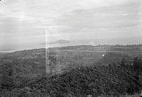
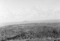
High view of the runways and Philip Island in the distance.
Associated document relates: "Looking south from the slopes of Mt. Pitt, these photographs show the two airstrips constructed by the Australian Dept. of Main Roads and US Forces consultants. The surface of the WNW-ESE strip comprised perforated interlocking steel matting, while the surface of the SW-NE strip comprised crushed rock similar to limestone, and was generally referred to as the "coral" strip. The "steel" strip is the one most nearly horizontal in the photograph. Philip Island is near the centre of the photograph, and Nepean Island near the left hand edge.
The control tower, original meteorological section and "D/F residence" are located on the airstrip intersection corner southwest from the camera. The RNZAF HQ unit containing the Orderley Room, signals and cypher office, telephone exchange, operations room etc is located in the clump of trees beside the left hand side of the coral strip on the side nearest the camera. The rectangular paved area adjacent to the coral strip is on the SW edge of trees hiding the HQ unit. The stores section is hidden in trees across the strip from the HQ Unit. The buildings next to the coral strip between the HQ unit and the left hand end of the coral strip are probably the transmitter and power generator buildings, with the antennae erected in the adjacent open space. The RNZAF camp is to the left of the transmitter buildings and near the NE end of the coral strip. This was the second RNZAF camp on Norfolk, the original campsite having been located a little north of the SW end of the coral strip on the cliffs above the ocean at Headstone."
Image from the David Andrew Dunn personal collection.
High view of the runways and Philip Island in the distance.
Associated document relates: "Looking south from the slopes of Mt. Pitt, these photographs show the two airstrips constructed by the Australian Dept. of Main Roads and US Forces consultants. The surface of the WNW-ESE strip comprised perforated interlocking steel matting, while the surface of the SW-NE strip comprised crushed rock similar to limestone, and was generally referred to as the "coral" strip. The "steel" strip is the one most nearly horizontal in the photograph. Philip Island is near the centre of the photograph, and Nepean Island near the left hand edge.
The control tower, original meteorological section and "D/F residence" are located on the airstrip intersection corner southwest from the camera. The RNZAF HQ unit containing the Orderley Room, signals and cypher office, telephone exchange, operations room etc is located in the clump of trees beside the left hand side of the coral strip on the side nearest the camera. The rectangular paved area adjacent to the coral strip is on the SW edge of trees hiding the HQ unit. The stores section is hidden in trees across the strip from the HQ Unit. The buildings next to the coral strip between the HQ unit and the left hand end of the coral strip are probably the transmitter and power generator buildings, with the antennae erected in the adjacent open space. The RNZAF camp is to the left of the transmitter buildings and near the NE end of the coral strip. This was the second RNZAF camp on Norfolk, the original campsite having been located a little north of the SW end of the coral strip on the cliffs above the ocean at Headstone."
Image from the David Andrew Dunn personal collection.
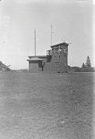
Control Tower at Norfolk Island.
Associated document describes: "View of the SW side of the control tower located at the intersection of the airstrips. The medium frequency direction finding loop, sense antenna for the D/F set, signal mast to warn of arriving or departing aircraft by raising the "sausage", and meteorological mast over the small square meteorological instrument room are all illustrated in this photograph."
Image from the David Andrew Dunn personal collection.
Control Tower at Norfolk Island.
Associated document describes: "Control tower viewed from approximately south at about the same time as photograph No. 5 [1986-016.3.5] The ground floor of the tower was probably used by the meteorological section prior to their relocation further along the steel strip. Note the path leading off to the right of the picture to the D/F residence comprising sections of airstrip steel matting."
Image from the David Andrew Dunn personal collection.
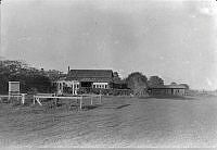
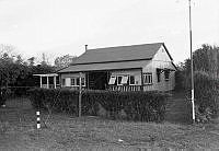
Farm buildings used by the RNZAF at Norfolk Island.
Associated document describes: "An early view of the D/F residence located behind the control tower with a fenced off area for meteorological instruments."
Image from the David Andrew Dunn personal collection.
Control Tower at Norfolk Island.
Associated document describes: "Control tower and D/F residence photographed almost from the centre of the runway intersection. The house accommodated all of the original five members of the D/F section who fended for themselves independently of the main camp. Cooking and household chores were shared between the five. Stores drawn from the stores section and main camp messes were at times augmented by the gathering of wild fruit and vegetables, and frequently by gifts from generous Norfolk Islanders. The islanders also extended hospitality by frequent invitations to meals. This "later" photograph was taken after the relocation of the meteorological section and its instruments. It also shows the enclosed signal panels in front of the tower."
Image from the David Andrew Dunn personal collection.
Farmhouse building used by the RNZAF on Norfolk Island.
Associated document describes: "A later view of the D/F/ residence. The mast on the right hand side supports the end of the emergency D/F transmitter antenna.'
Image from the David Andrew Dunn personal collection.
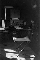
Direction Finding equipment at Norfolk Island.
Associated document describes: "This medium frequency radio direction finding unit (not radar) was installed in the control tower to provide a continuous 24 hours per day service. (Note. The control tower windows have been covered for taking of the photograph). The )-360 degrees bearing scale can be seen on the left of the operator's desk, the handwheel for rotating the loop below the desk and )-360 degrees scale, and immediately above, the shaft extending up through the tower's roof to the loop."
NB. The above is the first part of an extended description of the operation of the D/F equipment.
Image from the David Andrew Dunn personal collection.
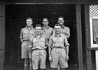
Group. Direction Finding Section personnel. Norfolk Island.
Associated document describes: "The original D/F/ section photographed on the verandah of the D/F residence. Back row left to right - Aircraftman Ron Pearce, Corporal Bruce Evetts, Aircraftman Ross Noonan. Front row left to right - Aircraftman Dave Dunn and Gordon Findlay.
Bruce Evetts and Ross Noonan were the first D/F operators posted to Norfolk, followed by Dave Dunn, Ron Pearce and Gordon Findlay all within a few weeks of each other. The number of D/F operators on Norfolk later increased considerably following installation of a high frequency direction finding station near Steel's Point."
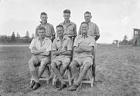
Image from the David Andrew Dunn personal collection.
Group. Direction Finding Section personnel. Norfolk Island.
Associated document describes: "The D/F section after Cpl. Bruce Evetts' posting back to NZ and the arrival of two more operators.
Back row, left to right - Aircraftman Dave Dunn, Jack Litt, Gordon Findlay.
Front row, left to right - Aircraftman Ron Pearce, Corporal Bob Smith and Aircraftman Ross Noonan.
Corporal Bob Smith suffered a heart attack and was invalided back to NZ."